Every year I produce about 100 illustrated maps of fly fishing destinations for three magazines, Northwest Fly Fishing, Southwest Fly Fishing and Eastern Fly Fishing. I've been doing this since 1999, when the publisher launched the premiere issue of Northwest Fly Fishing. It's been a good "gig" for me in a variety of ways, and I've come to appreciate landscapes from a bird's eye view.
I've decided to develop the style of maps I do for the magazines into a large-format, more fully-rendered piece of art that shows off these very interesting places… some places I have fished, some places I'd like to fish.
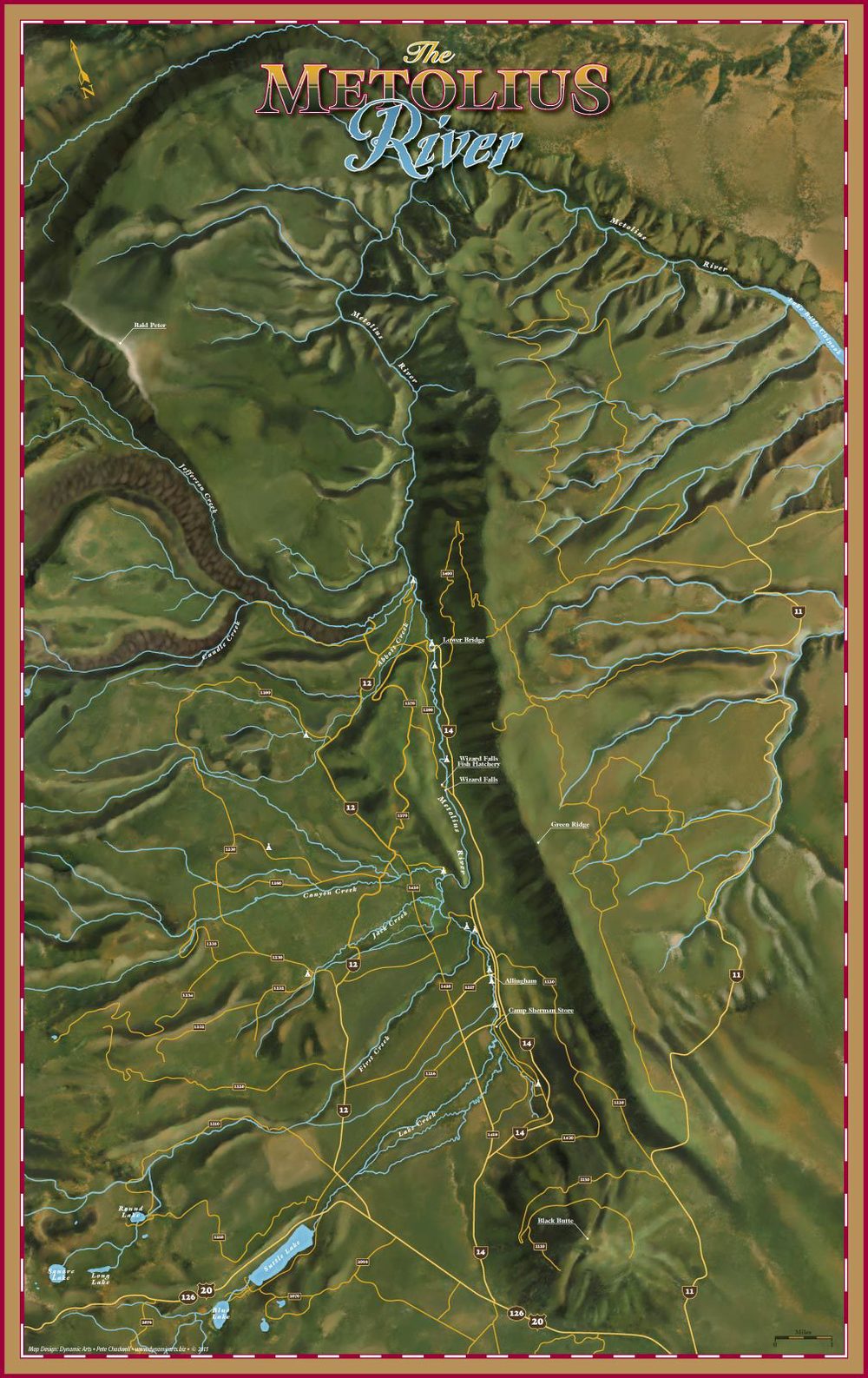
I've begun with the Metolius River, a little more than an hour's drive from my home here in Central Oregon. The Metolius is a beautiful spring creek which also takes on quite a bit of snowmelt from tributaries as it rolls toward its confluence with the Deschutes River at Lake Billy Chinook.
I'll be making this available as an art print here.
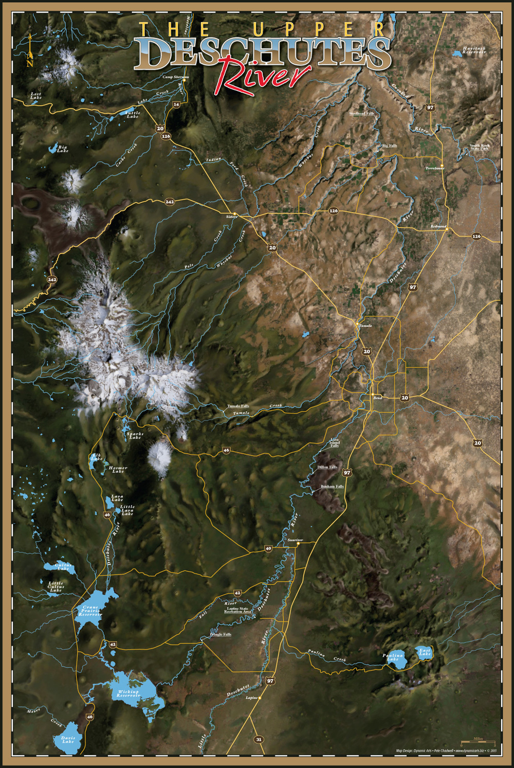
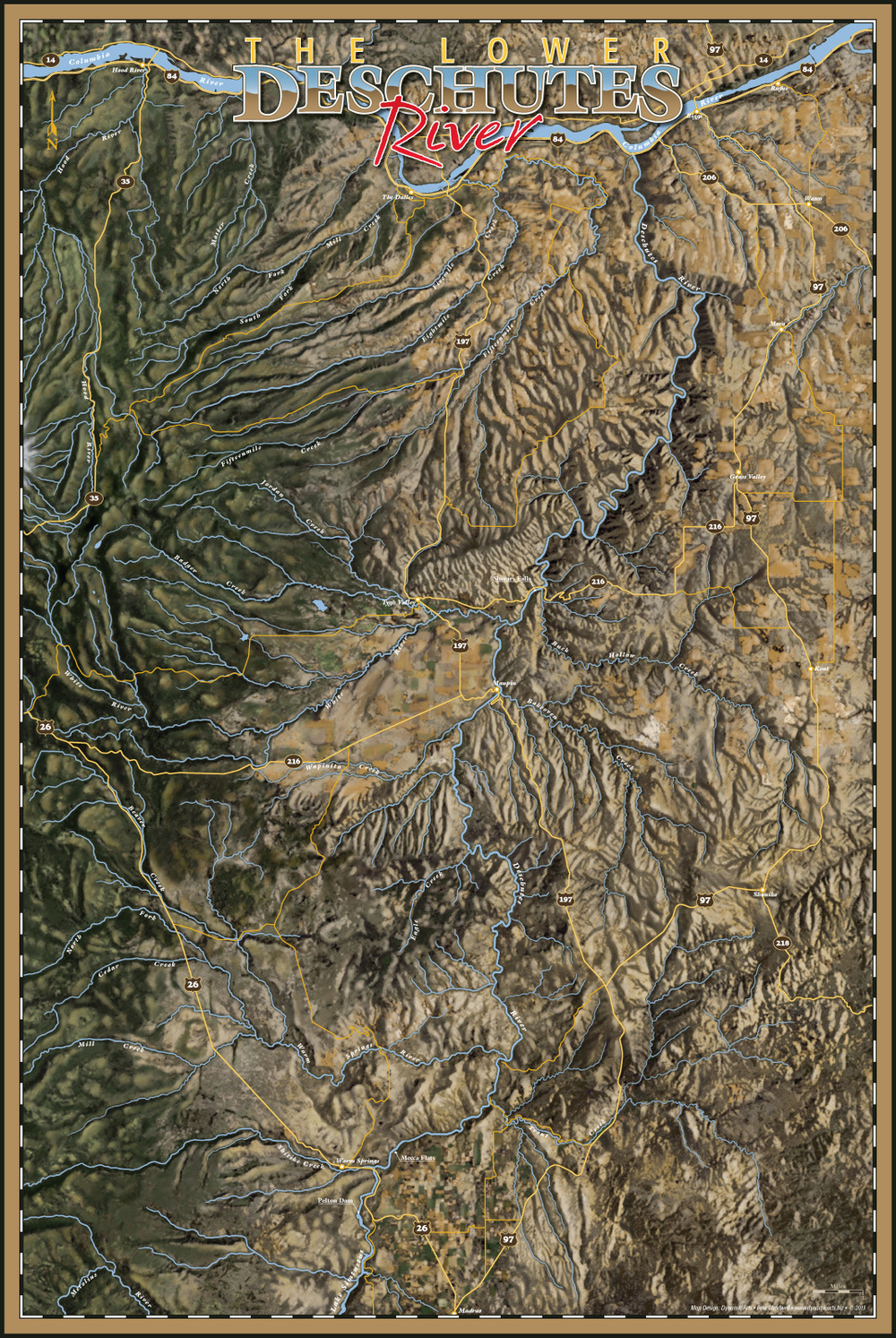
Of course then there's the Deschutes River… world famous for its trout and steelhead fishing. The Deschutes flows 252 miles from its source at Little Lava Lake (4747' elevation) to the Columbia River (164' elevation). I've broken the river into two sections, the upper section from Little Lava Lake down to Lake Billy Chinook, and then from Lake Simtustus all the way down to the Columbia River. The geology of this area, especially in the upper reaches, is fascinating. The river flows past huge lava flows and the landscape is spotted with miniature volcanic cones.
These will also be available at FineArtAmerica very soon.